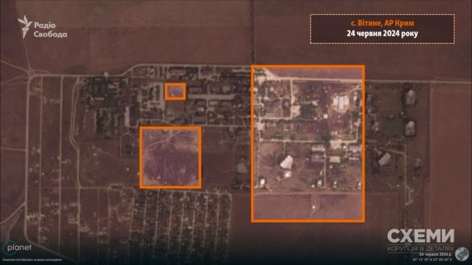
Satellite images show consequences of attacks on Russian military facility in Crimea

A satellite has documented traces of fires at a Russian military facility in Vityne near the city of Yevpatoriia in Crimea where explosions occurred on 23 June.
Source: Skhemy with reference to Planet Labs satellite images
Details: OpenStreetMap shows that the 40th Separate Command and Measurement Complex (Deep Space Communications Centre), which is part of the Aerospace Forces of Russia, is located here. This is an important military unit within Russia’s space communications and satellite navigation system.

Military expert Anatolii Khrapchynskyi said Liana satellite surveillance and data collection systems, including Lotos and Pion-NKS satellites, are located at this centre. Pion-NKS uses active radiolocation for naval reconnaissance and data collection.
Khrapchynskyi added that the Russians may also be using this centre to control groups of satellites which "are designed to jam enemy satellites’ communications signals".
Support UP or become our patron!